

aGISs is passionate about all things geospatial and data. Agile and creative, we are collaborative and supportive of our clients and love to share our knowledge.
View all ServicesI'm a seasoned Geologist, have extensive Geological, Mineral Resource Management, and Production experience in the alluvial and marine diamond mining sector. I am registered as a Geological Scientist with the Council of Natural Scientific Professionals and a member of the Geological Society of South Africa. I am an expert Business Intelligence (BI) Specialist responsible for the design, development, implementation, management and support of the company management information system. I've worn many hats in my career-Geologist, Programmer, Software Developer, Spatial Data Management and Mineral Resource Manager and as a result have a unique ability to manage multi-disciplinary projects and challenges.
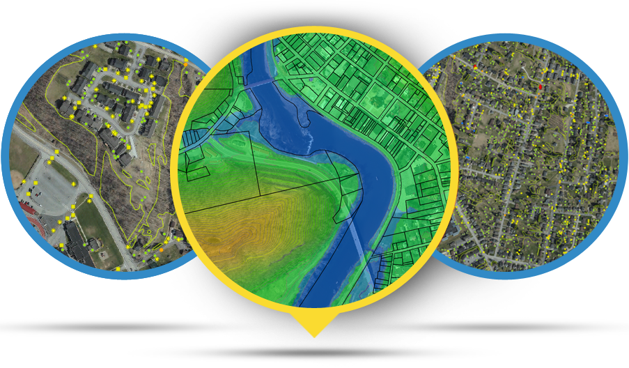
aGISs is highly experienced in data compilation and geographic information system (GIS) services. aGISs utilises ArcGIS 10x as a framework for gathering, managing and analysing data in conjunction with Surpac™, as part of its suite of services. aGISs has excellent understanding and experience in capturing new or historical project data (geological and assay) in whatever form, in order to compile spatially corrected data into a single unified co-ordinate system as fits the client’s requirements by means of geo-referencing the various data-types.
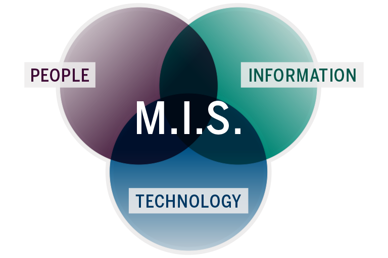
aGISs offer the unique, tailer-made management information system (MIS) development services for companies across South Africa. Our management information system provides relevant data to ease your decision making, it controls information overload by managing detailed facts and provides data clarity. MIS helps to measure the employee or equipment performance and enables to take decisions on organizational plans. It detects the problems and coordinates with the users to enable them to respond to the problems promptly. We support you in building a business-specific MIS application based on your organisational needs.
Our service offering includes Environmental Management Programmes (EMPs), environmental permitting and licensing, environmental audits and compliance monitoring, mine closure and rehabilitation planning, and social impact and development plans. Specialist advisory services include water, biodiversity, air quality, soils and waste, backed by some of the biggest names in the industry.

aGISs is experienced in marine and alluvial diamond deposits. aGISs focuses strongly on the geological component by generating geological models which serve as a solid foundation to any Mineral Resource Estimation. This is accomplished with team work between the exploration geologists and the resource geologists. The geological models are based on sound geological / first principals.

The aGISs team is qualified to conduct Resource Estimations on marine and alluvial diamond deposits:- The team is very proud of its approach with:- strong geological focus ; ensuring best-practice high quality estimates; conducted in accordance with SAMREC Reporting Codes; and undergo rigorous review before release.
-
7 Perdebos Road, Protea Valley, 7530 RSA
Sean: +27 82 442 7622
sean.damons@agiss.co.za